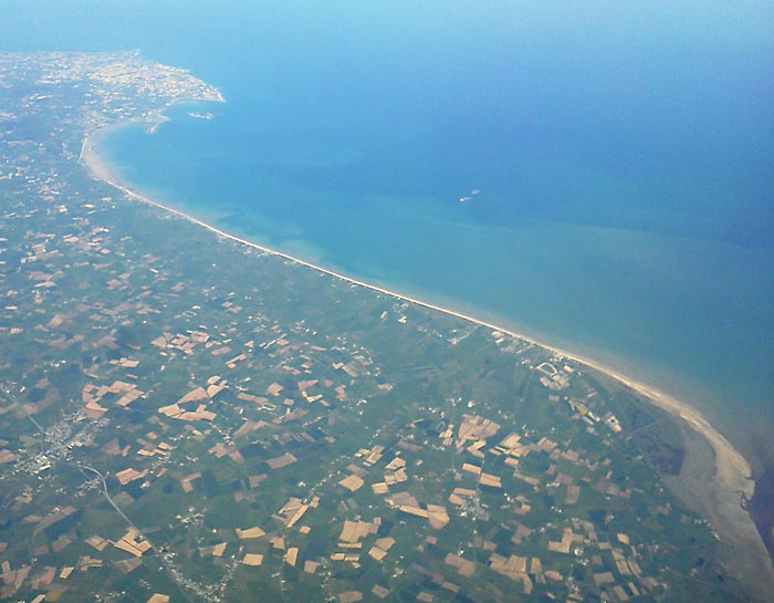
It's June 6 - the anniversary of the Allied invasion of Normandy during World War II. I normally wouldn't think to create a post about this day, but just a few weeks ago I was fortunate to photograph one of the beaches involved in the invasion from a jet I was flying from Germany to the U.S. It was a very clear day, and although I didn't have a camera with me I did have my Sony tablet. The camera quality is not very good, but I did get a reasonable photo of the coastline when the pilot announced that we were flying over Normandy.
Here is my photograph:
And here is a Google Maps satellite view, with the corresponding area circled in red.

Finally, here is a diagram showing the different beaches that were invaded as part of that massive effort to attack the German forces and re-take France and eventually all of Europe. As you can see the codename for the beach I photographed is Utah beach, which was the destination for the westernmost invasion forces during this operation. Actually Utah beach is only about a 3 mile segment of the beach that I flew over.

If you want to read more here is the link to the Wikipedia entry for Utah Beach.
See more of my photography at: Photography by Matt Schrier
Here is my photograph:
And here is a Google Maps satellite view, with the corresponding area circled in red.
Finally, here is a diagram showing the different beaches that were invaded as part of that massive effort to attack the German forces and re-take France and eventually all of Europe. As you can see the codename for the beach I photographed is Utah beach, which was the destination for the westernmost invasion forces during this operation. Actually Utah beach is only about a 3 mile segment of the beach that I flew over.
If you want to read more here is the link to the Wikipedia entry for Utah Beach.
See more of my photography at: Photography by Matt Schrier
No comments:
Post a Comment